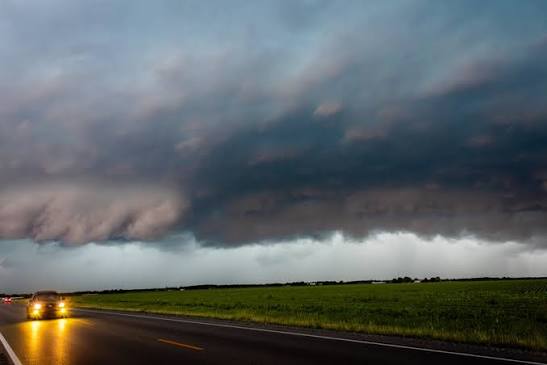
Eastern Hamilton County residents face repeated rounds of heavy rain, lightning and possible flooding through Saturday evening as a stalled cold front parks over the region.
The National Weather Service's Wilmington office issued a severe thunderstorm warning early Friday, Aug. 7, for eastern portions of the Greater Cincinnati area, including Batavia and Goshen in neighboring Clermont County. The warning expired Friday morning after the storm weakened below severe limits, but the underlying threat did not leave with it.
Anderson Township, Mariemont, Terrace Park and Newtown all sit within the broader storm impact zone. A Hazardous Weather Outlook remained active for all of Hamilton County as of Friday morning.
What's happening
A cold front that pushed in from the west Thursday stalled overhead, creating what WLWT meteorologist Randi Rico described as a focus for repeated rounds of downpours and storms through Friday afternoon and evening. Conditions at Cincinnati/Lunken Field as of 10:53 a.m. Friday read 79°F with 79% humidity and a dewpoint of 72°F, confirming the muggy air mass fueling the storms.
"Heavy downpours and lightning would be our concerns, especially for people attending outdoor events this weekend like the VOA Country Music Fest," Rico said in her Friday forecast.
Local12 Chief Meteorologist John Gumm echoed the concern on X, warning that the strongest storms Friday afternoon and evening could produce strong wind gusts, dump heavy rain quickly and cause isolated flooding.
Storm chances decrease somewhat after sunset Friday but do not disappear. Rain remains possible overnight into Saturday, with additional downpours expected Saturday before the front finally moves out Saturday evening. Sunday looks relatively quiet, but more rounds of heavy rain are forecast Monday through Wednesday.
Third significant event in three weeks
This is the third notable weather event for the area since mid-July. The July 21 storms brought flash flood warnings, tornado warnings across seven Tri-State counties and nearly 11,000 power outages to Hamilton County, prompting a mayoral emergency declaration through Sept. 15. The NWS also recorded a tornado event on Saturday, Aug. 1.
Hamilton County homeowners affected by earlier flooding recently gained access to a $2 million county relief fund as FEMA aid remains out of reach.
Outdoor events in the crosshairs
The storm pattern coincides with major outdoor events in the area. The VOA Country Music Festival in West Chester Township, expected to draw 75,000 people through Sunday, is monitoring conditions closely. Brianna Wooten, West Chester Township's director of public information and engagement, told WVXU on Wednesday that officials are working with public safety professionals and local Emergency Management Agency resources to provide advance lightning warnings using two strike detectors near the venue.
How residents can prepare
In the township's 2025 emergency preparedness guide, Anderson Township Administrator Vicky Earhart advised residents to be prepared to take care of themselves for at least three days during major weather events, noting that emergency services may be limited in how many people they can reach promptly.
Residents can sign up for Alert Hamilton County at AlertHC.org to receive NWS watches, flood warnings and emergency notifications by text, email or phone. The system offers 42 alert types.
To report storm damage or flooding, contact Anderson Township Fire and Rescue's non-emergency line at 513-688-8400 or the Hamilton County Emergency Management Agency at 513-263-8200.